Science happens daily in the San Luis Valley. Fortunately, this gives me the chance to use my college degree. As the sweltering heat begins at the lower altitudes and we stride into the official beginning of summer, be it known, there is relief! Go high! I had the chance to do several high altitude adventures this week. One fact of weather science is that the atmosphere cools with altitude - about 1 degree Centigrade per 100 meters higher, equivalent to about 2 degrees Fahrenheit for every football field stood on its end. The sun can feel warmer because there are less air molecules to scatter the light rays, but, the ambient temperature does drop.
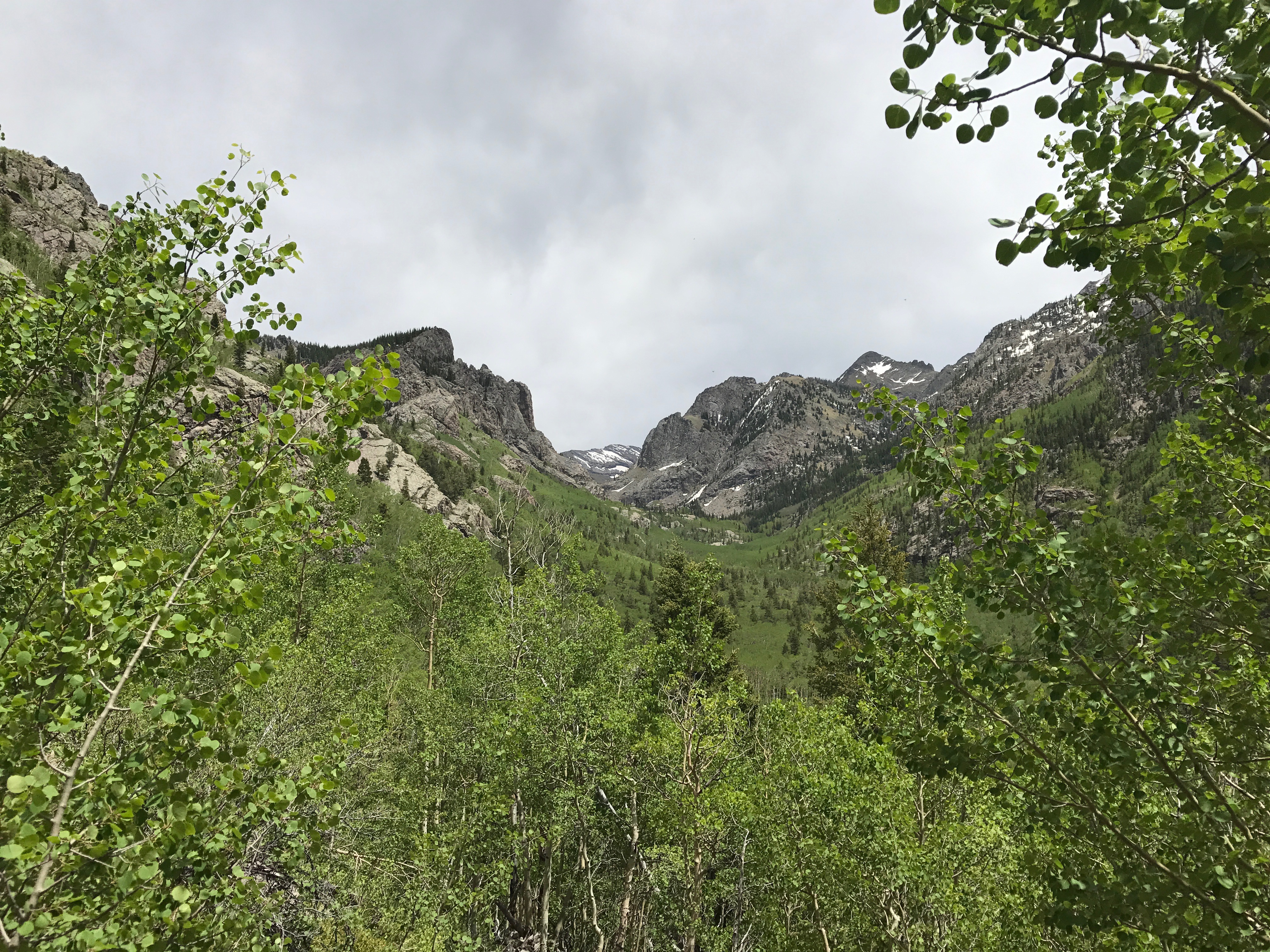
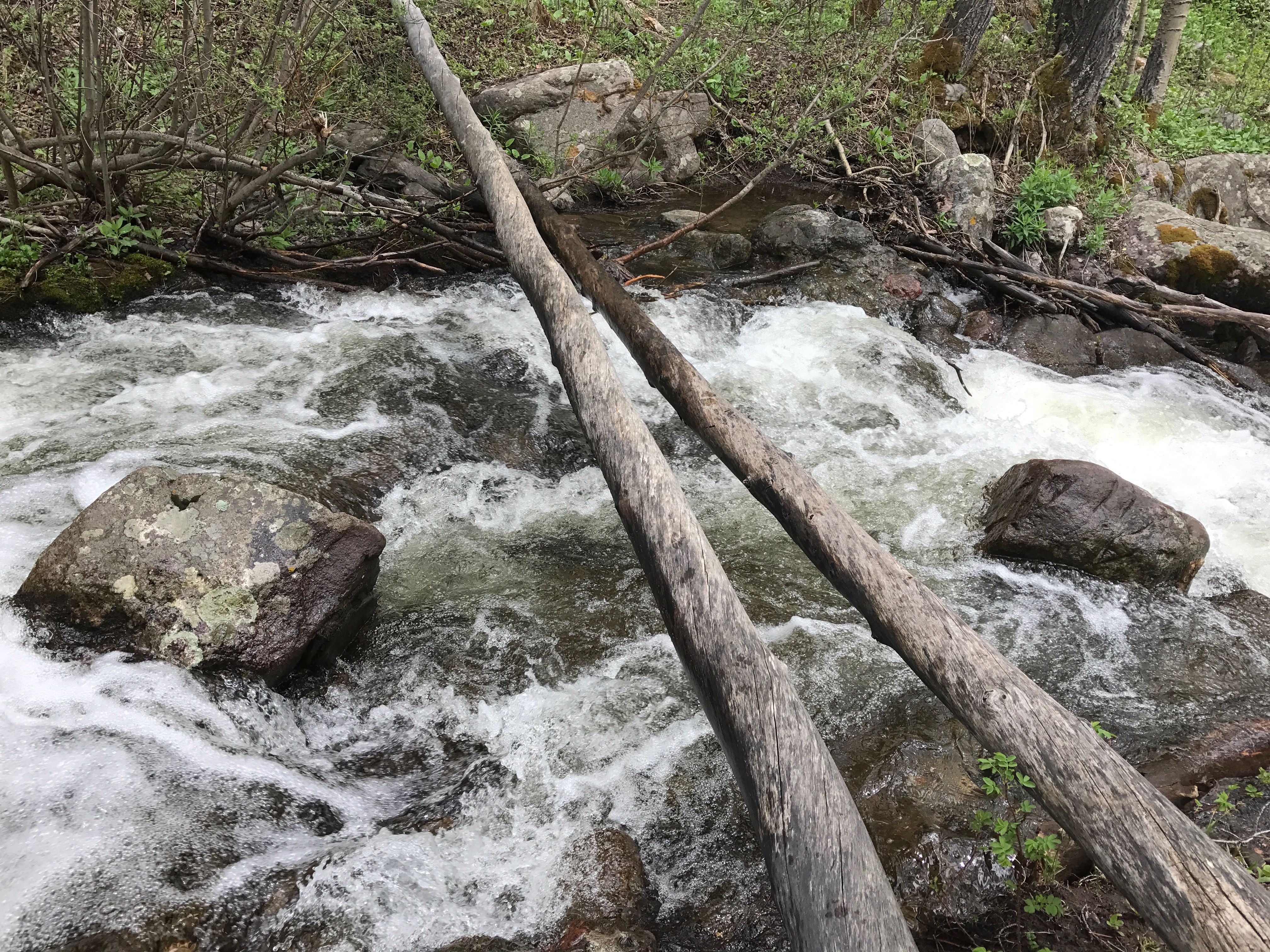
North Crestone Trail - the deep snowpack of this winter was also late in starting to melt. Last week, North Crestone Creek was cranking! Numerous tributaries that drain hidden mountain valleys all tumble down ravines into the main creek that exits the mountains and flows swiftly onto the valley floor. The process goes like this. Longer days elevate temperatures above freezing, sunlight is absorbed on the south facing slopes, further heating the ground around deep snowpack areas, snow crystals, now turned into snow cone ice, hit the magic temperature of 32 and go through the physical change of ice crystal to liquid water, which, unlike the solid form in which it just resided, is now pulled down by gravity. Each ice crystal 'nudges' many of the others in the snowfield and more ice crystals become water, join together, and tumble downhill toward the next mini tributary of the main creek until they become a roaring monstrous flow of swift moving water. I started at 8 thousand six hundred feet and hiked to 10 thousand 8 hundred feet where the temperature felt like what people would consider a perfect fall day - mid seventies, warm sun, light breezes, and deep blue skies. One note of caution. Spring runoff is cold and some stream crossings during snowmelt will initiate hypothermia in under a minute if you fall in to the fast water. And the streams, though they make look harmlessly small, are anything but. I crossed one rickety two log bridge that was ill advised, as I was alone, and having done that one, when I reached the next creek crossing, I got smarter, no way, too dangerous.
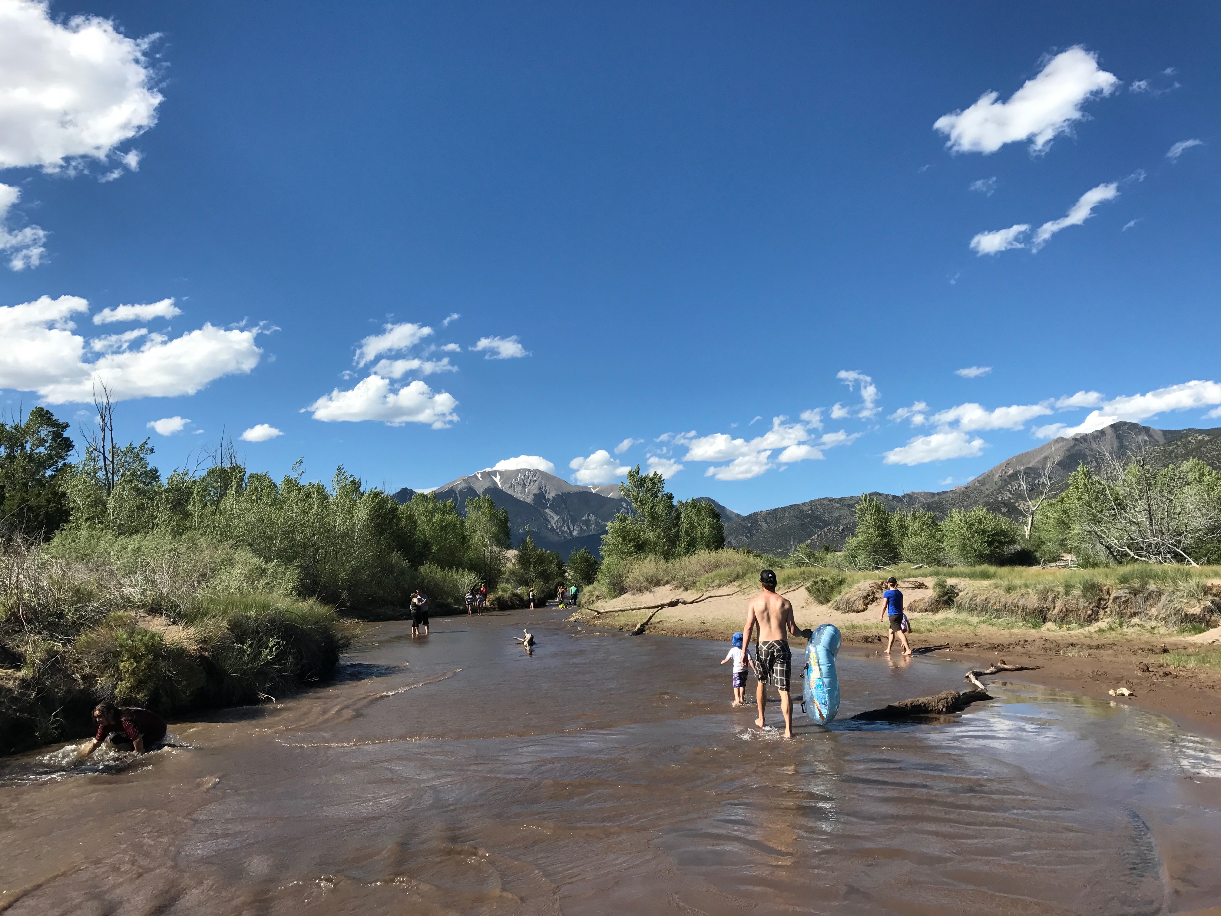
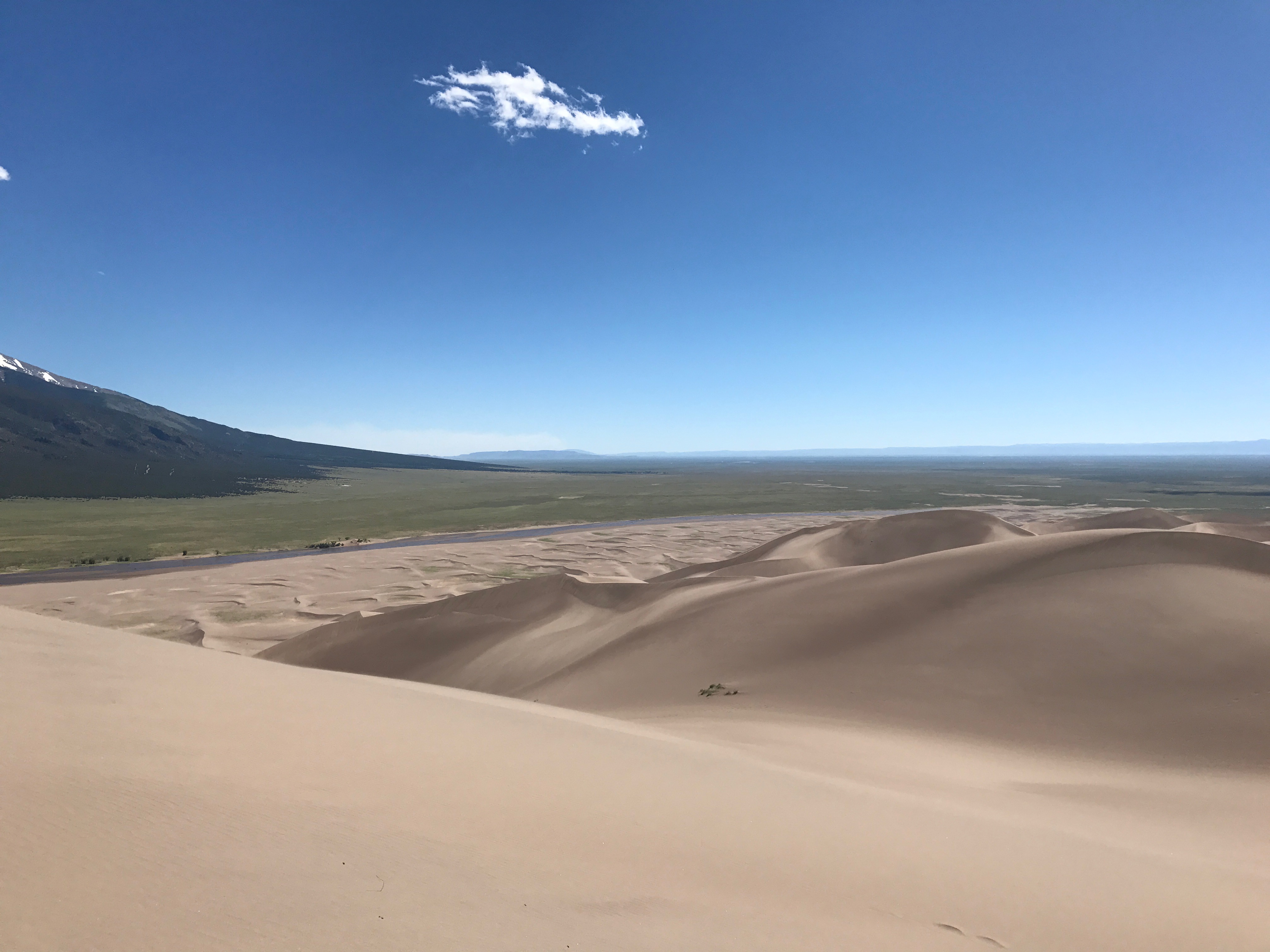
June day at the Great Sand Dunes - the purpose of this expedition was to take my digital food thermometer and take temperatures in and around the dunes. The day was busy and I parked a few hundred yards up the road from the main parking lot. Mosca Creek flows down from Mosca Pass along the road as it becomes a tributary of Medano Creek that flows across the sand dune flats. I walked past many cacti in 30 yards to the creek. Water temperature - 48. I walked down to the short dune trail, took off my shoes and socks like everyone else as Medano Creek was flowing directly on the south side of the dune flats. The 'surge waves' were a foot deep. The water was cool but not cold. Temperature - 72. Medano Creek, though a mountain stream in origin has a couple of miles of flowing across sand to reach the main hiking trail from the parking lot. On cloudy days the water would be much colder but the sun was hot and bright this day. The water darkens the sand over which it is flowing, creating a more absorbent color for sunlight. The water warms 25 - 30 degrees in just over a mile making it a wonderful temperature for tubing, frolicking, hiking, almost no different than walking the ocean shore! I crossed the creek and walked into the dry sand of the creek bed. I took a surface temperature. 112. Ambient air temperature - 74. I reached the dune field and measured again on a dune slope facing the sun. Surprisingly 'cool' at 116. There was a good wind blowing so I was assuming the air moving over the sand was pulling the heat radiating off the sand to help keep the surface cooler. I had been there on a sunny, yet cooler day in April, (in the low 60s) and the sand was too hot for bare feet that day, probably closer to the 140 degrees listed in the Sand Dunes Guide about which hikers are warned. Generally, go early to avoid burning feet or where proper shoes/sandals to avoid blistering and extreme pain.
I made it to the top of High Dune, 700 feet above the base. Ambient air temp - 71. Close to the 2 degrees per 300 feet in elevation gain, but the air temp at 5 feet off the ground may have picked up some of the radiant heat from the dunes. The winds were blustery. Sand temp there was also 116. I bounded down and found one spot out of the wind and did get a reading of a high temp on the sand of 120.4. Such was my thermal investigation day at the GSDNP. All in the name of sand dune science.
Meanwhile, across the valley on the CDT (Continental Divide Trail) on top of Wolf Creek Pass at 10,800 feet, science was also happening. I hiked north. The first part of the trail is through massive stands of beetle kill pine. The forest had nearly a 95% kill as the recent outbreak of pine beetles, possibly worsened by global warming, took a major hit. But, Mother Nature is on her own time schedule to heal the forest and young trees, unaffected by pine beetles, are growing on the forest floor, green and lush from a wet winter. The massive number of dead trees are falling over, will decompose and become part of the fertilizer to feed the new trees and the many species of plants that grow at 11,000 feet and higher up the mountainsides. As a wildlife ecologist, my excitement trigger was tripped by...
"Holy Pocket Gophers Batman! Look at all the evidence of gopher activity over the winter!"
"Yes, Robin, they've left their dirt, but now that they no longer have the deep snow to hide them, they have disappeared underground as all smart northern pocket gophers do when they need to hide from their enemies."
Interesting lifestyle these high altitude gophers have - (Thomomys talpoides). They live underneath the deep snows and some of their specialized adaptations are as follows: They tunnel through soils, eating roots of grasses that come down into their tunnels. With their front feet, their big teeth and their chest, they are miniature bulldozers. They dig up in to the snow, create tunnels (tubes), and push the dirt up into these tunnels. They live in conditions with very low oxygen levels which allow them to have carbon dioxide concentrations in their blood that would be fatal to humans. It must have been a good year for the gophers as evidenced by the number of dirt tunnel mounds (called eskers). Looked like an over population number to me. Which means, their predators, hawks, foxes, badgers, coyotes and other species who dine regularly on gophers, will eat well this summer.
The CDT is presently not easily passable in spots. In the deep trees and on north facing slopes, the snow is still four feet deep. I made it out 2 miles but my feet were soaked and cold from sinking into the corn snow. One ravine on the north facing side of the eastern part of the divide, would have offered 1200 vertical feet of uninterrupted skiing had I been so inclined. This ravine supplies water to the south fork of the Rio Grande. The views from the CDT are spectacular and can easily be reached from the parking lot directly at the top of Wolf Creek Pass. Let your wondering mind wander! Science happens.