The Great Sand Dunes are certainly on center stage at the National Park. However, nearby trailheads offer routes into the backcountry with fewer people, scenic wonders and offer a good alternative activity when the Dunes are either too hot in the sun or perhaps, as on some days, too windy as Mother Nature has a 'dune sculpting day' and the dunes are inhospitable to human activities.
The Mosca Pass Trailhead is located a quarter mile from the Visitors Center. The trail map is in the newspaper guide from the entrance gate or in the Visitor Center (VC). There are 20 parking spots at the trailhead, or, you can leave your car at the VC as I did on a wild weather May day. Signs at the trail beginning will give you background about the pass as a toll road as early as 1871, a bit about the geology of the trail, possible wildlife sightings from bears to Bighorn Sheep (I saw an aging male who probably was not going to make it for long.).
The small community of Montville was established there when the toll road was having as many as 40 wagons a day come over from the Huerfano Valley in search of a new life either in the San Luis Valley or points beyond.
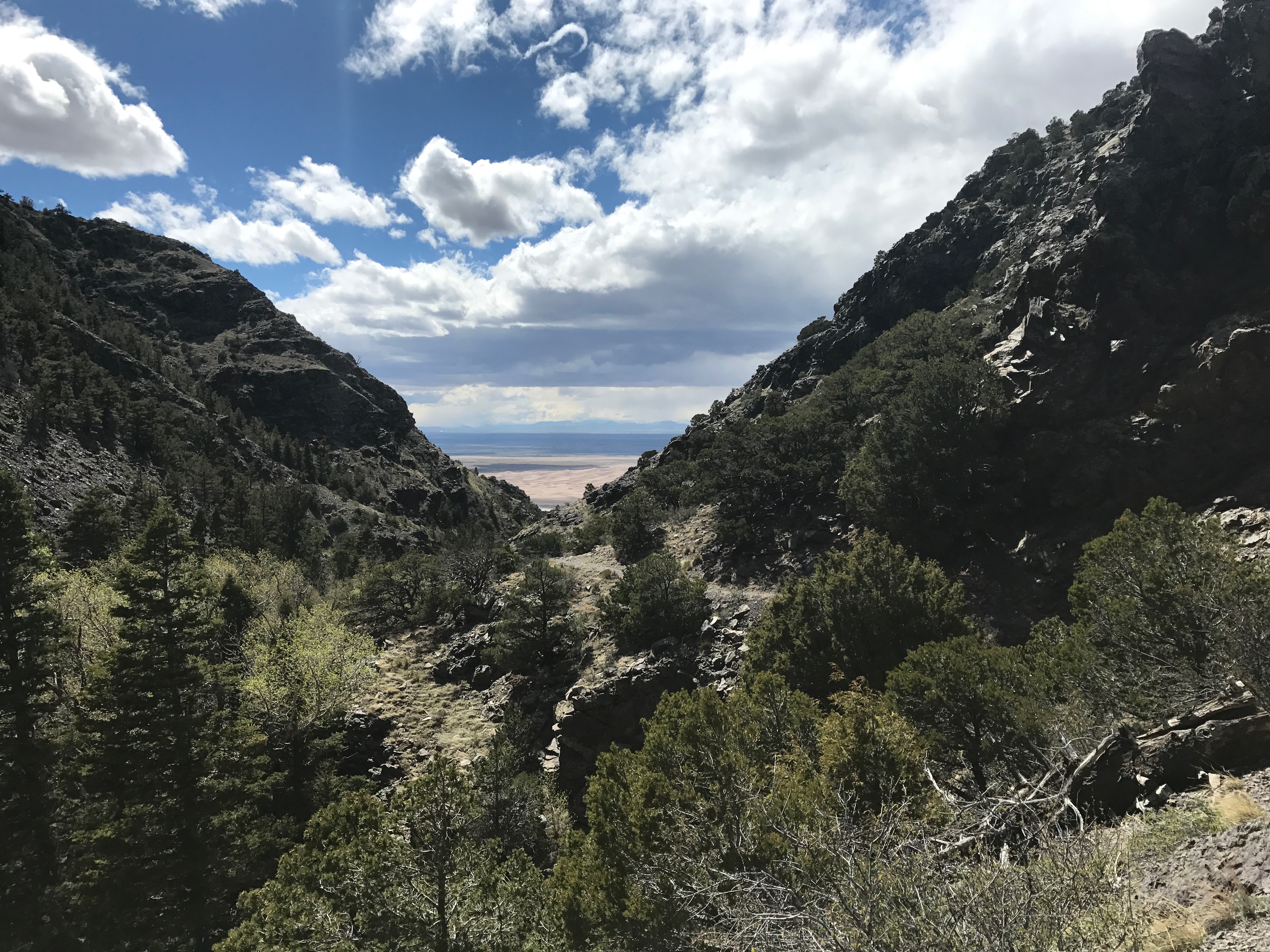
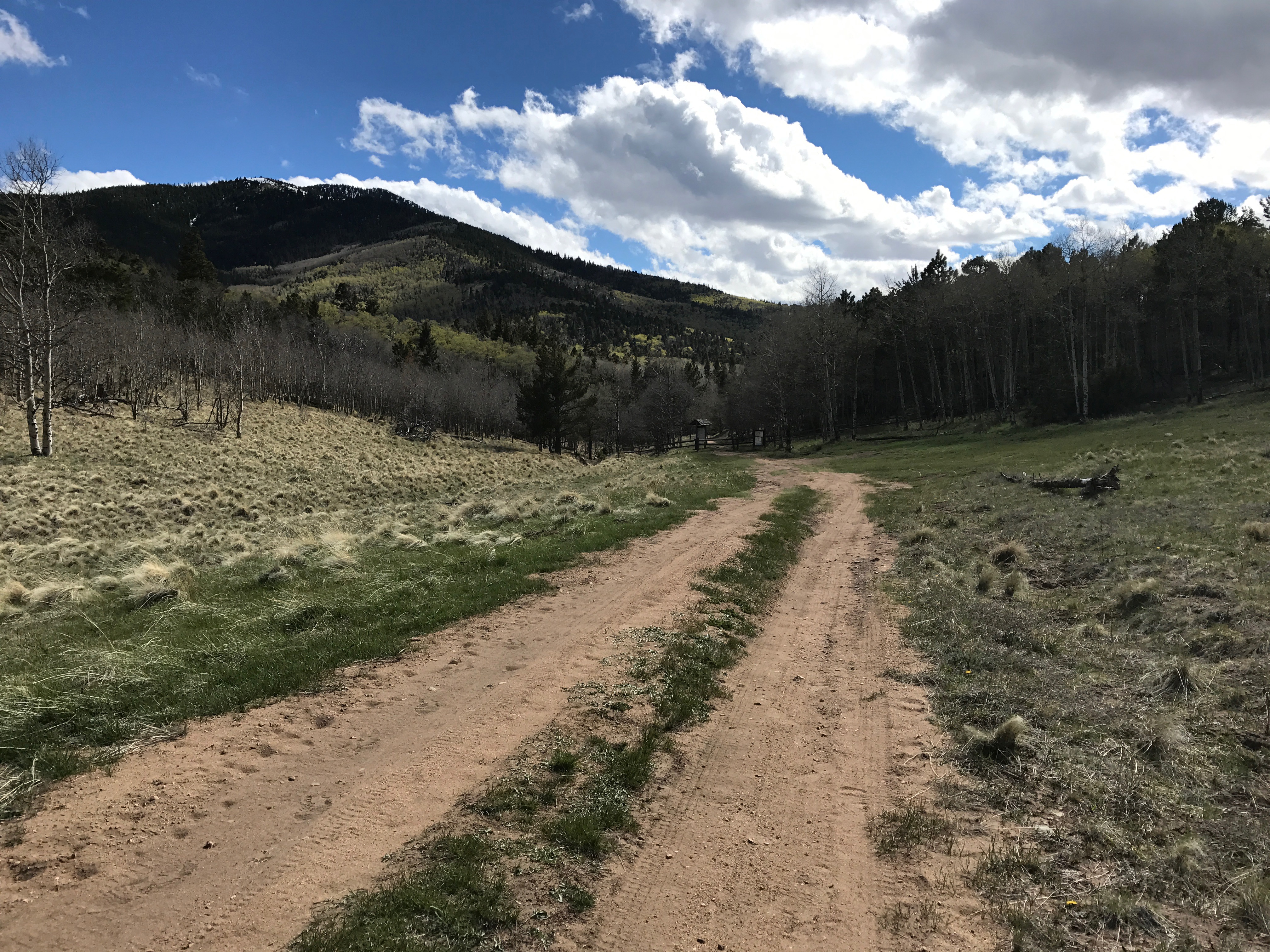
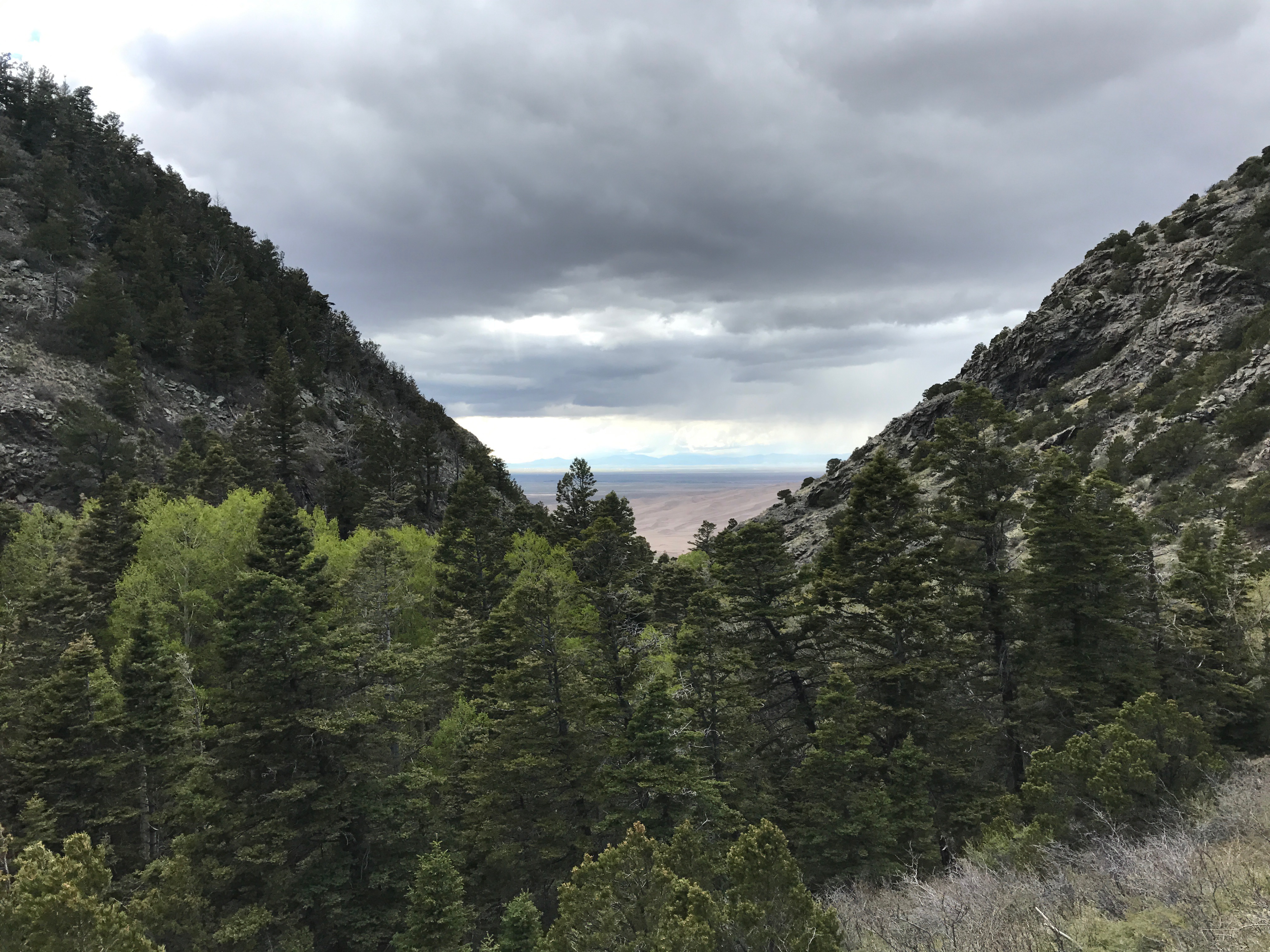
The wind was ripping as I started the trail as a late spring storm was passing through. That did not deter a number of visitors to the Dunes. The first part of the trail starts in a combination pine and aspen forest along Mosca Creek, a small gentle flowing stream that would be a water source on the trail if water was needed, all but the last half mile to the top of the pass. The trail is a steady steep for the first two miles of the 3.5 mile trip to the top. (9747 feet according to my GPS) At mile two the trail seems almost flat across grassy meadows. The trail exits the official NP and becomes the Great Sand Dunes Preserve in the Sangre de Cristo Wilderness Area. Backpacking and horse packing are allowed with less restrictive rules than the NP. Rocks and cliffs along the trail give way to almost rolling hills as the intense high peaks of the Sangre de Cristo’s are not visible from the trail. Signs and fences at the 3.3 mile mark exit hikers into the San Isabel National Forest to the top of the pass at another quarter of a mile making the distance consistent with the 3.5 mile one way on most trail guides. A Forest Service access roads from the top goes into the Huerfano Valley and access to Westcliffe Colorado.
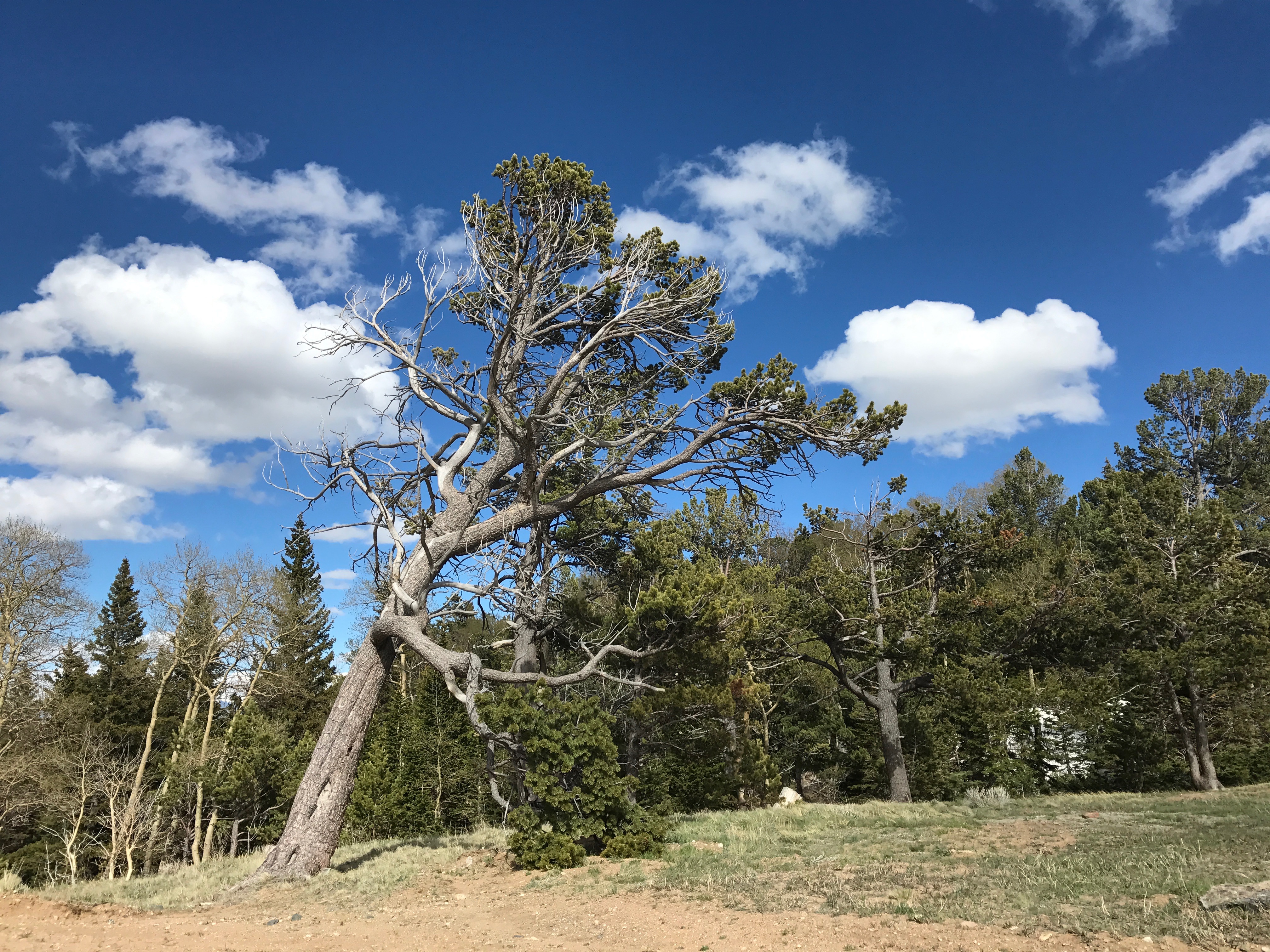
The roads are in good shape as I wandered a bit down the east side of pass to get a better view of the valley and the Wet Mountains. For me, the fascinating part at the top is that the wind funnels through the pass and accelerates via the hydraulic effect, where the pressure from the prevailing westerly winds cause the air to accelerate. As a result, the larger pines are leaning hard to the east with very few branches on their western facing sides. Amazing how the wind sculpts the trees but yet the trees battle back and survive, just in very unique shapes! And parts of the trail are the gravel road that has been there since being a toll road in the 1870s which followed the ancient paths of the native peoples in their travels to hunting grounds and trading routes with other tribes. As 7 mile round trip hikes go, this one is easy and fun. On the way back to the Visitors Center, looking west, parts of the sand dunes are visible through the giant 'V' shaped glacial carvings from the last ice age. 12,000 thousand years ago, you could have been on an adventure to see your first Woolly Mammoth hanging out in the San Luis Valley. Not much has changed the terrain since then. Enjoy!