
Length: Variable, pick a segment to hike
Difficulty: Moderate to Difficult
(This trail is a portion of the Continental Divide Trail)
Driving Instructions
From Alamosa, drive US 160 West 65 miles through the towns of Monte Vista, Del Norte and South Fork to the top of Wolf Creek Pass. The slowest section of this road is the first 10 miles out of South Fork as US 160 is two lane through the narrows of the south fork of the Rio Grande but once you pass through the first highway tunnel it will become four lane to the top of the pass. 160 is a main East/West route across southern Colorado and has a lot of truck traffic. Allow drive time of 80-90 minutes.
Trailhead Parking
The top of Wolf Creek Pass allows parking on both sides of highway, but the larger parking lot is on the south side where the sign for Wolf Creek Pass is located. It can be busy, but generally always has a spot open. Most people only stop temporarily to read about the history of Wolf Creek Pass and the Continental Divide. Its free and pets are okay.
Elevations
The top of Wolf Creek Pass is 10,850 feet. The trail tops out on this section at 11,700 feet, right at tree line.
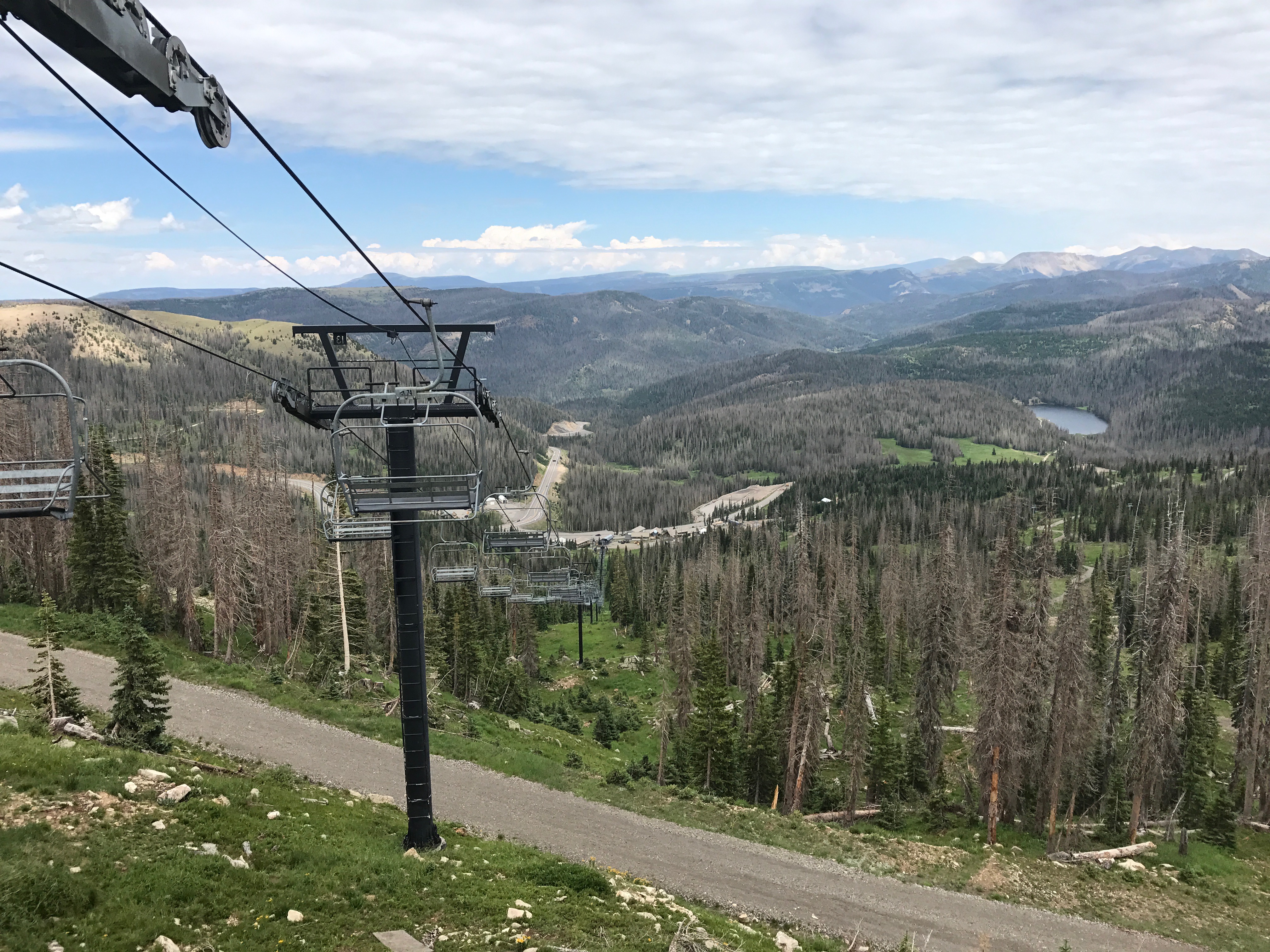
Description
The trail crosses the small meadow at the top of Wolf Creek Pass and quickly gets into the pine forest. Switchbacks begin immediately but are not too steep. Beetle kill pines are still standing and creak in the mountain breezes, making the forest sound haunted. Boulder fields are crossed in several places and then the trail reaches the top of the Wolf Creek Ski area and provides big views to the East and West. The trail levels out above the ski area and provides great views to the south and west. The trail has steep drop-offs to one side while stunted trees show which way the prevailing winds blow.
Terrain
The trail starts off on the north facing slopes and may be snowpacked or muddy. Roots and rocky in places as the trail crosses several boulder fields. It is easy an trail above the treeline and past the ski area.
Water/Bathrooms
None. The top of Wolf Creek Pass is 18 miles West of South Fork and 24 miles East of Pagosa Springs.
Pleasures and Perils
Life is good on top of the Continental Divide. The snow that melts on the San Luis Valley side of the trail drops into the Rio Grande and heads toward the Gulf of Mexico. On the Pagosa Springs side, water flows into the San Juan River and to the Colorado River. Beautiful views extend in all directions and give great perspective of the southern San Juan Mountains. This is mountain lion and bear country but they are rarely seen, as the trail is heavily used. Steep drop-offs in several places. Beetle kill pine trees can fall in heavy winds. There can be thunderstorms in the summer. Be careful with kids and dogs.
Notes
The Continental Divide Trail North starts directly across the highway. Also great views and a good hike. About the same difficulty and terrain as the trail heads north toward Canada. Wild strawberries and raspberries in places during their season.


