
Length: 7.25 Miles Round Trip
Difficulty: Moderate to Difficult
Driving Instructions
From Alamosa, drive US 160 west for 47 miles to South Fork. Take a right on scenic Colorado Hwy 149 to Creede for 21 miles. Take a right in Creede on Main street, which will take you through town, up the hill into a steep walled canyon. Pass the Mining Museum and other buildings, take the Bachelor Loop Road until it forks. Numerous interpretive signs for reading about the mining history are along the road before officially entering the Historic Mining district. Depending on weather, the road may be closed in the winter, but could be cross country skied.
Trailhead Parking
There are numerous places to park vehicles near the signs. Free parking. Pets are allowed. East Willow Creek road is the right fork. It receives much less traffic than Bachelor Gulch Road and is the preferred hiking/running/mountain biking route for the loop.
Elevations
Beginning elevation is 8,907 feet. CR 502 tops out at 10,452 feet before beginning descent back toward Creede.
Description
This one lane gravel road travels past old mines and ruins of Colorado’s amazing mining history. Creede’s mines produced more silver than any other mining towns in Colorado. The steep walled canyons of the Bachelor Gulch road are not so pronounced on the East Willow Creek side as you will pass mines on the side of the hill as you get toward Phoenix Park, the site of an ore mill reclamation project. An interpretive sign is there. From that point, the road begins an ascent up through steep switchbacks toward the high point through pines and aspens. The last two miles back to parking lot are a steep gravel road past extensive mine ruins. Attempt to absorb the history.
Water/Bathrooms
Both available in the town of Creede. Water along trail with proper filter or treatments.
Terrain
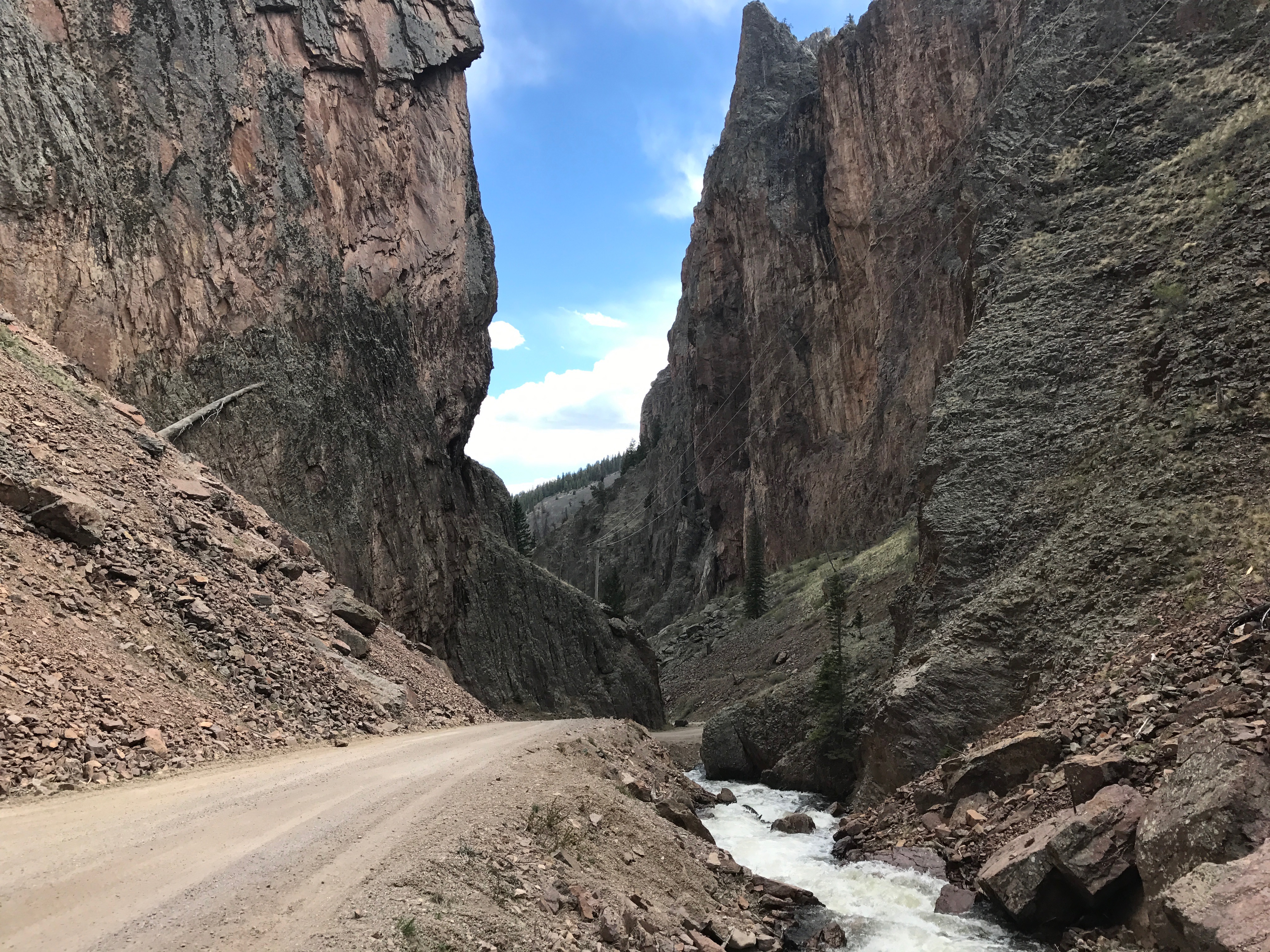
East Willow Creek Road is an easy gravel road for hiking and mountain biking in a narrow valley. This is a gradual ascent along the creek until Phoenix Park when the road leaves the valley and switchbacks of the mountain face. Good views of higher peaks emerge through the forest and then back south toward Creede will put you on CR 503 to Bachelor Gulch Road. The descent is steep through high walled cliffs and past massive old mining processing buildings. It is uniquely scenic.
Pleasures and Perils
It is the best place in Colorado to see historical mining activity, buildings and structures all in one place. The vertical geology of these intersecting canyons are like nothing else in Colorado. Dust kicked up by passing vehicles can make it unpleasant to breathe. Have a handkerchief to cover your nose. Old mines are for viewing only. They are dangerous especially for curious children. Be aware of 4 wheelers and vehicles on these roads. Tight canyons and this part of the San Juans can get big thunderstorms. Know the weather of the day.
Significance
Creede, though far off the beaten path in Colorado, has as colorful of a mining history as Cripple Creek, Leadville and other mining towns, along with a cast of characters to complete the amazing historical past. It is well worth the trip!
Notes
Creede is now mostly a summer tourist town with a Repertory Theatre, restaurants and shops. Its the perfect day trip for all sorts of activities. Grab a brochure and read up on the town!


