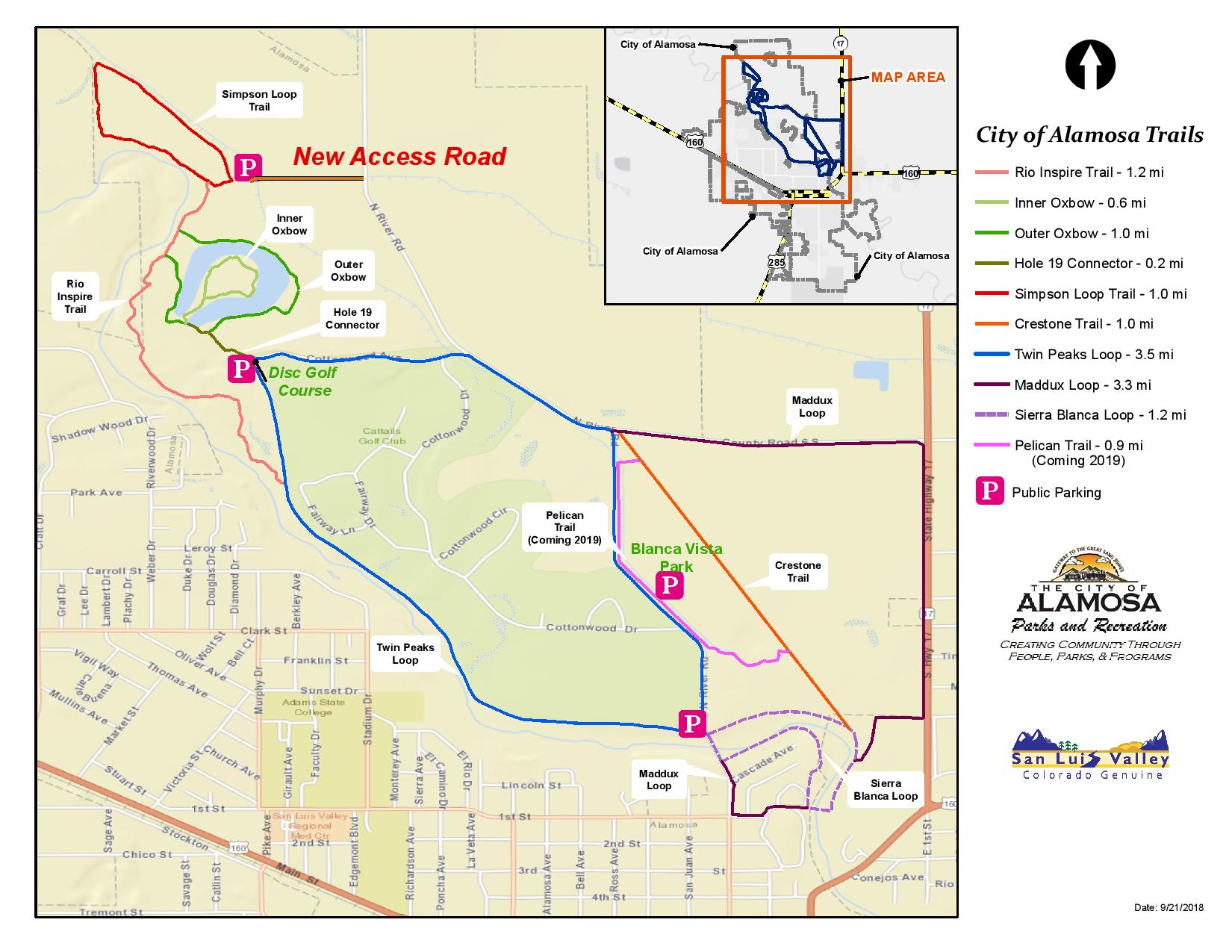
Length: 0.47 to 1.1 Miles Round Trip
Difficulty: Easy
Driving Instructions
From Alamosa, drive State Street North over the State Street Bridge (see Rio Grande Trail as trails can be accessed from here.) Or, continue past Cattails Golf Course for 8/10 of a mile on North River Road until it Ts. Take a left turn (west) for 4/10 of a mile and turn left on the gravel road until it dead ends in the parking lot where the frisbee golf course begins. To continue to the Simpson Loop, drive north on road for 4/10 of a mile and take the next left on the gravel road to the covered picnic table and parking lot.
Trailhead Parking
These trails all interconnect and can be accessed from 3 parking lots. State Street Bridge lot is the closest to town. Frisbee Golf Course parking lot is another 1.6 miles and Simpson Loop trailhead is 1.9 miles from State Street Bridge. All trails are free Dogs on a leash are allowed.
Water/Bathrooms
No water. Bring your own. A Port-a-potty is available at Frisbee Course parking lot.
Elevation
7,600 feet.
Description
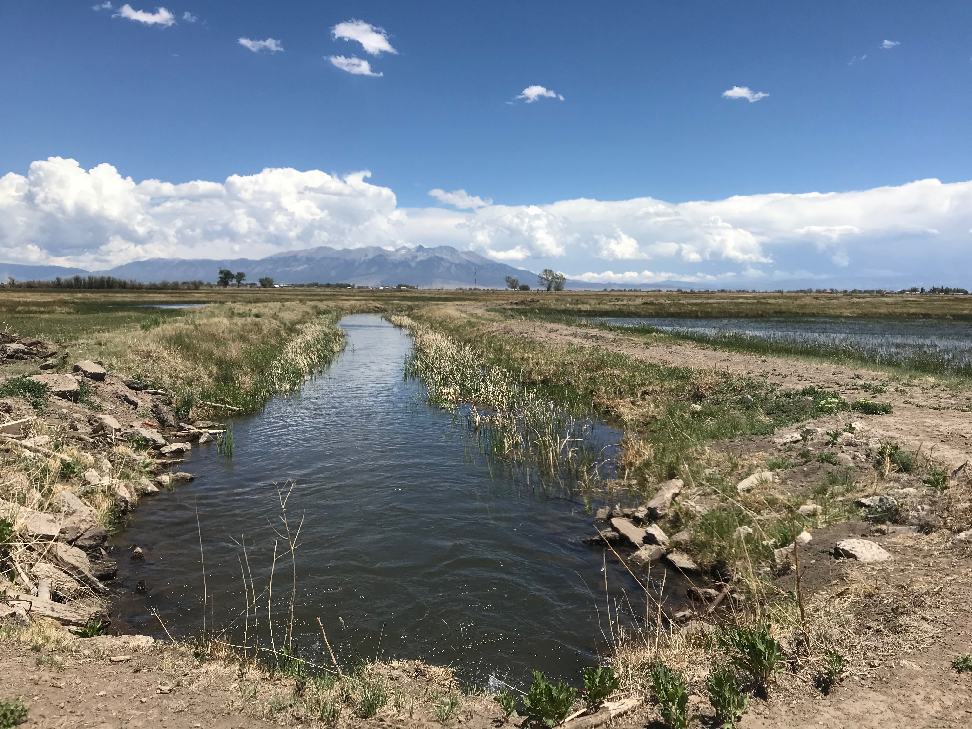
Inner Oxbow Loop is .47 mile. Outer Oxbow Loop is .9 mile. Simpson Loop is 1 mile. Rio Inspire Trail is 1.1 mile. Many of the loops are connected with observation stops along the way. These trails provide access to the bosque (forested woodlands along a river) and also the wetlands. The Oxbow Trails are old bends in the river. Rivers change their course over time, through natural processes or human made changes with dikes and diversions. This section of the river has had minimal changes. These trails are on delicate ecosystems, so please stay on trails.
Terrain
There are gravel and dirt trails along the river, through the cottonwood bosque and across wetland meadows. They vary from dry and dusty to wet and muddy.
Pleasures and Perils
For the most part, this is the Rio Grande, its wetlands and bosque in their natural states. Wildlife sightings are common, especially birds and waterfowl. Part of the lands are also used for cattle grazing. It offers unobstructed mountain views, especially East to Mount Blanca and the Great Sand Dunes are visible. There is uneven ground and cottonwood trees eventually rot out and limbs and whole trees fall, hence all the wood clutter on the ground in the bosque. Rattlesnakes are rarely seen. Other wildlife may be around as well. Watch for golf balls along golf course and flying frisbees near frisbee course.
Significance
The Rio Grande has another 1,300 miles to go to reach the Gulf of Mexico. You are seeing the clear headwaters of this river. Natural ecosystems along rivers are critical to the health of the surrounding communities as wetlands provide habitat, clean the water of human and livestock waste, restore groundwater and provide recreational opportunities.