
Length: 7 Miles Round Trip
Difficulty: Moderate
Driving Instructions
From Alamosa, there are two ways. Go North on Hwy 17, 13 miles from junction of 160/17. Take right/east for 14 miles to junction of CO 150 and left/north to Sand Dunes 5 miles. OR, go east on 160 for 15 miles to turnoff for Sand Dunes. Going this way, you will pass Zapata Falls Road and you can combine both the Great Sand Dunes and Zapata Falls in single day trip. Trail open April through November, depending on snow.
Trailhead Parking
200 yards past the Great Sand Dunes Visitor Center on right (overflow parking at the Visitor Center).
Elevations
8229 feet to 9747 feet (1,518 gain in 3.5 miles - most in the 1st 1.5 miles)
Description
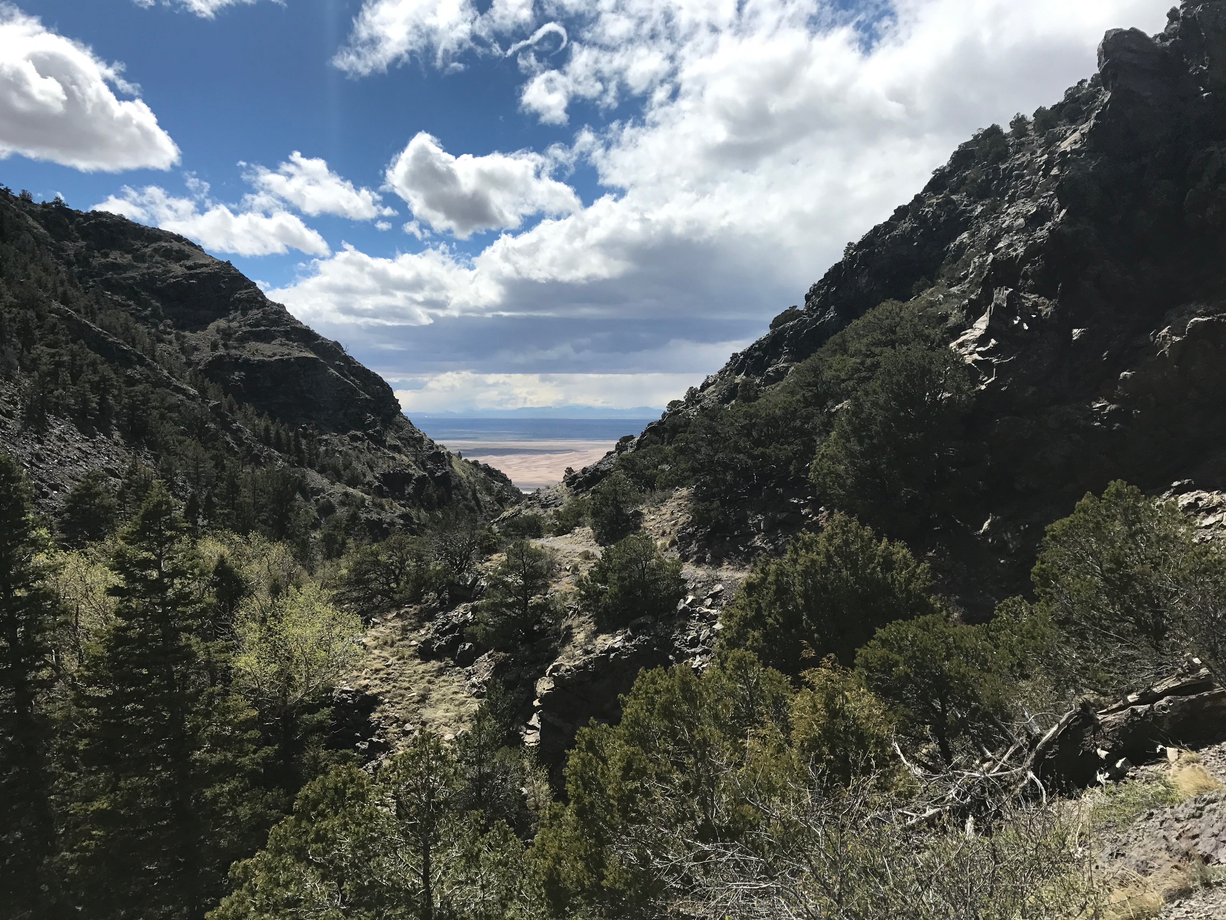
The trail begins in an aspen/pine forest along Mosca Creek. It’s cool and dark in the morning. It is a steep and slightly rough trail to begin, then levels out and becomes a trail in and out of meadows. There are views of the valley floor, but the Great Sand Dunes are mostly hidden by a mountainside to the North. Bighorn sheep, deer and elk are occasionally seen along the trail. You can view the Wet Mountain Valley to the east from the top. There is a gravel road that drops into the valley and the top of Mosca Pass and can be driven from the east side. Occassionaly in winter there are deep snow drifts due to prevailing winds that flow west to east that also shape the Sand Dunes!
Terrain
Rocky, tree roots, dirt and gravel. Easy footing. From April to June there could be ice and snowpack on trail making for somewhat slick or postholing footing on the lower section, along the creek in the shady portions of the trail. (Postholing is a term for walking on snow but when snow softens, falling through from shin deep to thigh deep.)
Water/Bathrooms
Water and bathrooms are available at the Visitor Center store.
Pleasures and Perils
If a day at the Sand Dunes is too hot or windy, this is a good alternative trail. It can be windy at the top and wind chill can make it much cooler at nearly 10,000 feet. Dress in layers.
Significance
Mosca Pass was a Native American footpath for the Ute Indians over the lowest point of the Sangre de Cristo Mountains. Westward expansion in the 1860s included miners, ranchers, and homesteaders looking for a place to live in the San Luis Valley which was now US territory (though Colorado was not a state until 1876). Mosca Pass became a toll road starting in 1871, through 1911, for many settlers and freight wagons, until a flash flood destroyed the road on the Great Sand Dunes side. On the lower mile and a half, it is hard to imagine the road being there, but the top 2 miles of the trail is the former toll road.
Notes
There is a fee to enter into the Great Sand Dunes National Park. Pets on leashes are allowed. Jim Ryun, one of America’s greatest runners, trained here for altitude acclimation to help him set several world records including winning a silver medal in Mexico City in the 1500 meters in 1968.


